The Mines and Geosciences Bureau (MGB) of the Department of Environment and Natural Resources (DENR) has started investigating the sudden appearance of sinkholes and ground subsidence across several areas in Cebu following the magnitude 6.9 earthquake that struck the province on Sept. 30.
The DENR-MGB on Sunday said an eight-member technical team, composed of geologists from the MGB Central Office and Regional Office 7, was deployed to conduct post-disaster geohazards assessment in areas hard hit by the strong earthquake.
DENR-MGB Director Assistant Secretary Michael Cabalda said the comprehensive geological investigation involves ground validation and geohazards data analysis.
“This study will enable us to pinpoint areas susceptible to flooding, rain-induced landslides, and those areas with high potential for ground subsidence and provide technical recommendations to LGUs for proper zoning, building regulation, and emergency preparedness,” he said.
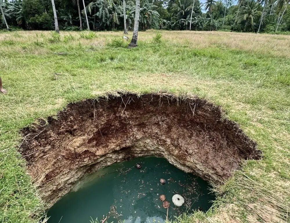
Cabalda noted that the recent earthquake exposed vulnerabilities of karst areas, a type of landscape that forms in places where the ground is made up of easily dissolved rocks like limestone, marble, or gypsum.
Over time, water seeps through these rocks, slowly wearing them away and creating unique land features such as caves, sinkholes, and underground streams.
Similar features can also form in areas made up of other kinds of rocks, like volcanic or sedimentary, which are then called pseudokarst. They happen when weak or cracked rocks and soil are eroded, creating big holes or depressions on the ground.
Sinkholes occur when the ground collapses due to loss of support underneath, while karst subsidence happens when the surface sinks or caves in, often triggered by sinkhole collapse or earthquakes.
The DENR-MGB said these hazards are dangerous, especially because it is very hard to predict where or when they might happen.
Cabalda said the agency’s assessment focuses on Cebu’s karst terrain, as these areas are naturally prone to underground cavity formation and collapse, particularly when shaken by strong earthquakes.
He said that preliminary surveys have been conducted in the proposed Tent City in Barangay Cogon, Bogo City, where several sinkhole-prone zones have been identified, and that initial findings were presented during the National Incident Assessment and Coordination Center (NIACC) meeting on Sunday at Camp Aguinaldo.
Cabalda assured that MGB geologists are coordinating closely with the NIACC, the Department of Human Settlements and Urban Development (DHSUD), and the Office of the Civil Defense (OCD).
On Friday, the MGB Region 7 already issued a “Subsidence Threat Advisory” to the municipal mayors of Medellin, San Remigio, Tabogon, Daanbantayan, and Bogo City after confirming new sinkholes and widening ground cracks in several areas.
Under the advisory, affected barangays were classified as high subsidence hazard zones, and urged LGUs to immediately enforce access restrictions, safety cordons, and public warnings.
The MGB also warned against backfilling of sinkholes without expert clearance to prevent further collapse and recommends close monitoring of ground cracks for signs of movement, especially after heavy rains.
It also urged the suspension of development in identified hazard zones and the implementation of detailed geotechnical studies to determine the extent of underground cave systems.
The agency also encouraged local chiefs to initiate readiness measures, noting that sinkhole development could progress through time as an increase in rainfall, lowering of the water table, or strong earthquakes could trigger ground subsidence or sinkhole collapse.